
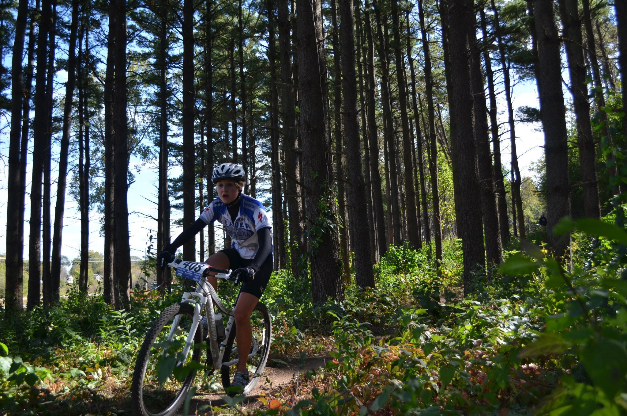
Mountain Biking In Rochester
RASC operates the trail systems in Rochester. We use the following apps for mapping and trail condition updates:
Trailforks - Maps & Routes
Trailbot - Trail Conditions & Closures
Riding is simple: Bring your bike to the designated parking lot, strap on your helmet, look for the trail entrance, and have fun! Because all skill levels are welcome, we follow the standard system of labeling our trails:
Green = Beginner (simple turns and hills)
Blue = Intermediate (tougher “technical” trails with skippable features)
Black = Advanced (very technical trails and/or unskippable features)
For common trail etiquette we recommend following IMBA’s “Rules Of The Trail”:
1) Ride on open trails only - Please obey any closure signage
2) Leave no trace - No littering and do not ride if trails are muddy
3) Control your bicycle - Ride within your limits
4) Yield to others - Be mindful of others enjoying the park
5) Never scare animals - This goes without saying!
6) Plan ahead - Bring sufficient water and supplies
Scroll down to preview our trails:
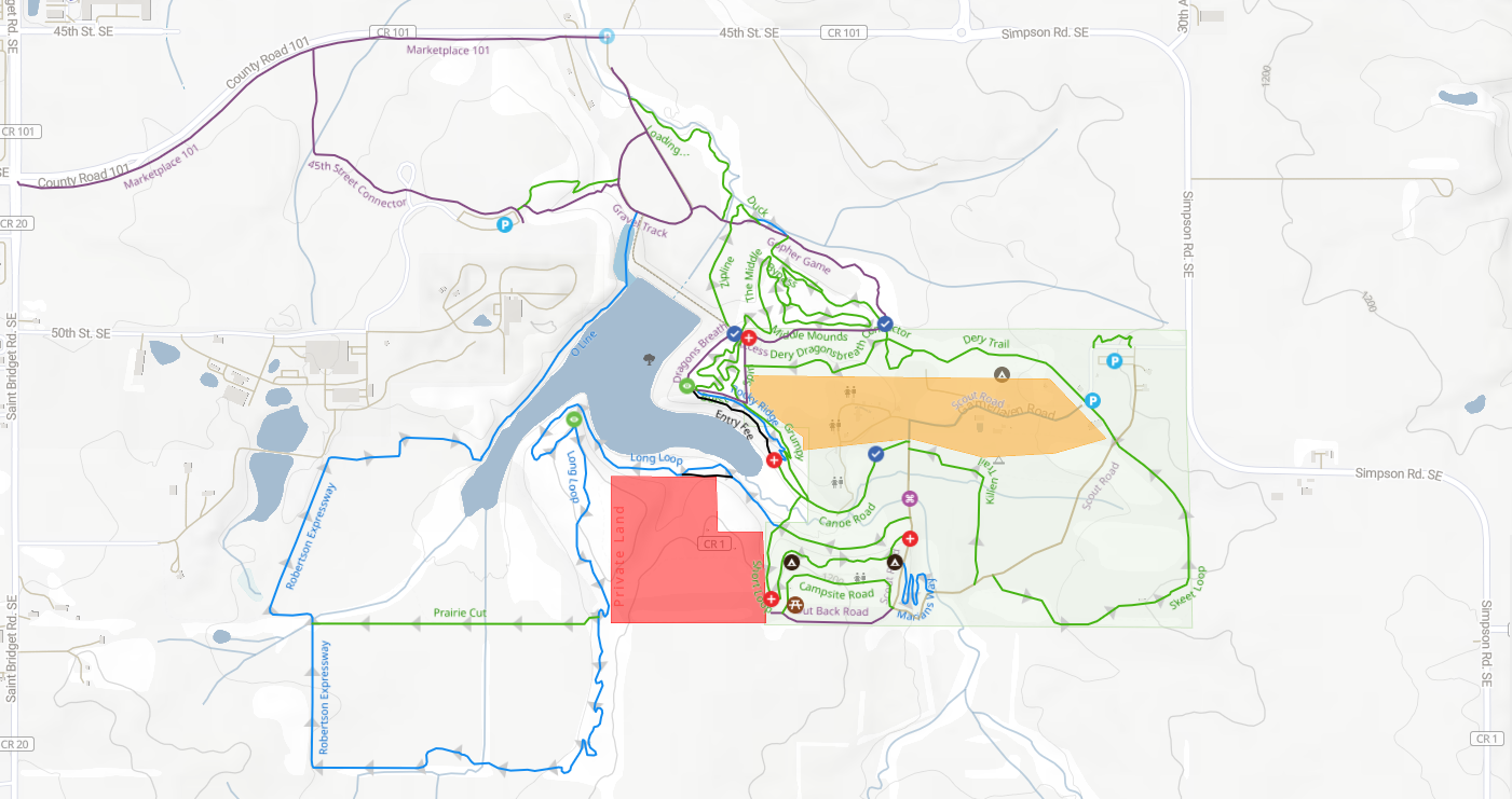
Gamehaven Park
(Click on map to open in Trailforks)
Google Maps: 43°57'07.7"N 92°26'29.7"W
2016 45th St SE, Rochester, MN 55904
Gamehaven Park is located in Southeast Rochester at the Gamehaven Lake Reservoir. This trail system contains up to 12 miles of singletrack through varying scenery with three beautiful overlooks. Please be sure to follow all signage as to not enter any Boy Scout territory and be mindful of disc golf baskets.
A new parking lot was finished for 2022. Expect to see many new updates for this park in the coming years!
Gamehaven Time Trial
During the June/July months, RASC sponsors a weekly Tuesday night time trial. Click here for more information.

Eastwood Park
(Click on map to open in Trailforks)
Google Maps: 44°00'42.5"N 92°24'36.9"W
3330 14 Hwy SE, Rochester, MN 55904
Eastwood is the original mountain bike park in Rochester. It was originally built in the 90’s and was divided by Towne Club Parkway in the early 2000’s. The East side of the park is more suited for flowy laps while the West side contains more features. Bring your old 26” bike for the full effect!
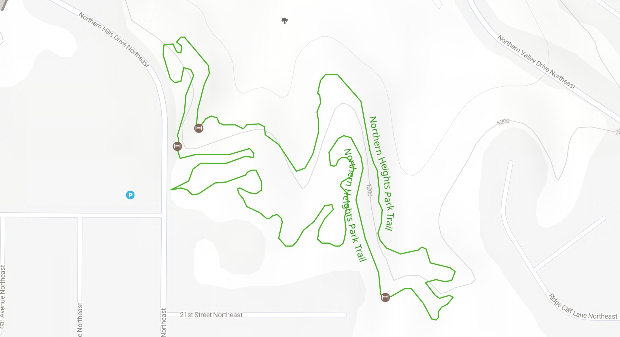
Northern Heights Park
(Click on map to open in Trailforks)
Google Maps: 44°02'44.9"N 92°26'46.9"W
919 22nd St NE, Rochester, MN 55906
Easy, multi-use singletrack. Northern Heights Park is a small, closed loop, 1.4-mile trail in Northeast Rochester, open to mountain biking and hiking. Enjoy this professionally designed trail through the southern portion of these 65-acre woods and you'll forget you're in the middle of a city. Despite the steep surroundings, and thanks to three constructed bridges, the trail only demands 95 feet of elevation gain for one lap, so it is perfect for beginners and casual users. Parking is available at the gravel lot across the street from the trailhead (near Churchill Elementary).